

Two Milestones for our Würzburg Small Satellites
24.09.2026
First Light for CloudCT and a Front-Row Seat on Krakatau
Just weeks after our nine Würzburg-built satellites rode to orbit together on July 7, 2026, two of the missions have already delivered striking results. The CloudCT demonstrator sent back its first observation, a view toward central France captured while passing over the Baltic Sea, showing both raw light intensity and a false-color rendering of the polarization of sunlight scattered by clouds.
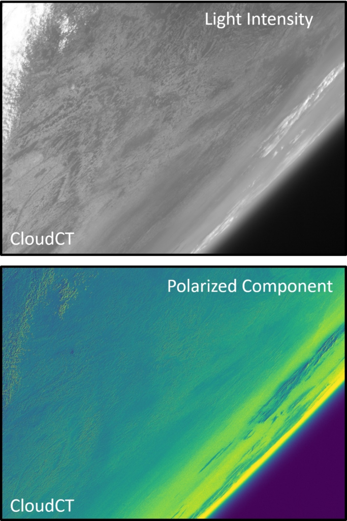
Earth covered by clouds in the upper left and the horizon is visible in the bottom right.
The satellite is a joint effort with the Weizmann Institute of Science and the Technion – Israel Institute of Technology, with the ZfT responsible for the satellite platform itself, backed by the European Research Council. You can read more on the Technion’s blog.
At the same time, our three TOM satellites proved themselves in a very different way: they happened to be flying directly over the volcanic island of Anak Krakatau when it erupted, and captured timely images of the ash cloud as it rose to roughly 15 km.
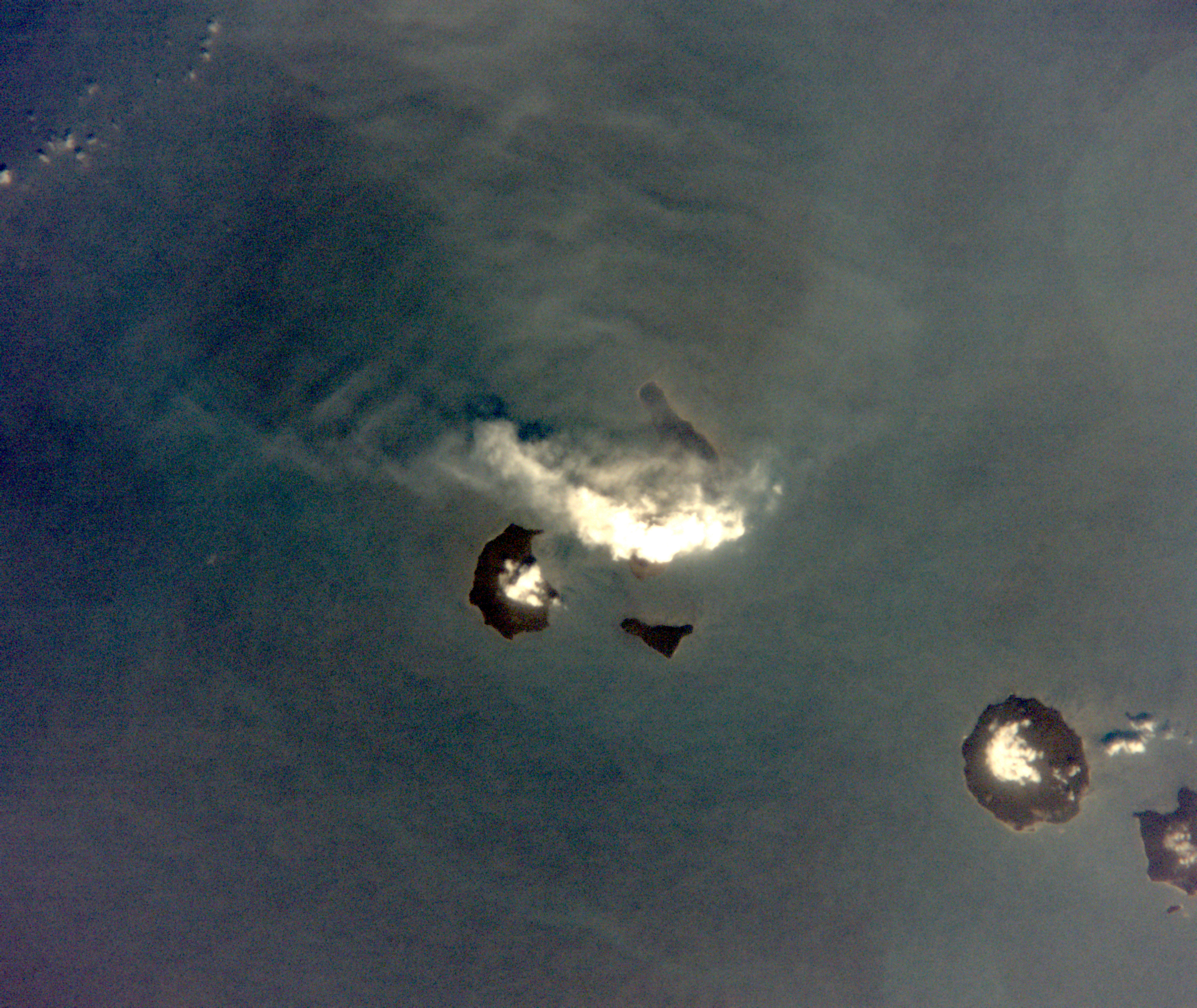
The eruption of Anak Krakatau, captured by TOM satellites during a flyover.
Built to generate 3D views of the Earth’s surface for disaster response, the shoebox-sized TOM trio showed how such small satellite formations could one day give emergency services and aviation authorities an early warning edge. This is information that matters given the eruption disrupted air traffic for around 340,000 passengers in the region. The full story is available via aerospace-and-defence.com.
Also from our region, the radio broadcaster Antenne Bayern and the Mainpost reported on this success story.
Magdalene-Schoch-Str. 5
97074 Würzburg - Germany
Daniel Eck (Geschäftsführer)
Telefon: +49 (0)931 615 633-10
Fax: +49 (0)931 615 633-11
E-Mail: info(at)telematik-zentrum.de
